
Participant Info
- First Name
- Katherine
- Last Name
- Parker
- Country
- United Kingdom
- State
- kaparker18th@gmail.com
- Affiliation
- Royal Geographical Society
- Website URL
- Keywords
- history of the book, history of cartography, history of maps and mapping, Pacific history, maritime history, history of exploration, history of empire, British Empire, naval history
- Availability
- Media Contact
- Additional Contact Information
- PhD
- PhD
Personal Info
- Photo
- About Me
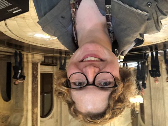
I am the Cartographic Collections Manager at the Royal Geographical Society in London, where I preserve and promote the Society’s more than one million cartographic objects. The position combines curation, librarianship, and research, alongside outreach and partnerships with academia, non-profits, and other partners.
I am a historian of exploration, specifically the European encounter with the Pacific, specializing in the production and dissemination of geographic knowledge by European empires in the long eighteenth century. I study the voyages themselves, as well as the texts and material culture they produced. This research has led me to be an expert on book, map, and globe making and use in the early modern period and the eighteenth century. I can also speak to the history of exploration more generally, to the study of Indigenous maps and mapping, as well as the legacies of European exploration and imperial expansion in today’s political, social, cultural, and intellectual arenas.
I also serve in the leadership of several scholarly organizations. I am the Administrative Editor of the Hakluyt Society, a Council Member of the Society for Nautical Research, and a Trustee of the International Society for the History of the Map.
Finally, and most passionately, I am a teacher at the university level. I teach the history of maps and mapping at the London Rare Book School, and I also am a part-time lecturer in architecture at New York University London.
- Recent Publications
* For access to any publications, please email me at kaparker18th@gmail.com *
Book:
Katherine Parker (author) and Barry Ruderman (images). Historical Sea Charts: Visions and Voyages Through the Ages. Milan: White Star Publishers, 2020.
Articles and chapters:
‘Mapping Indigeneity in the RGS-IBG Collections,’ with Peter R. Martin, Area 58 (2026), e70064.
‘Issue Editors’ Introduction: Indigenous Maps and Mapping,’ part of thematic issue on Indigenous Maps and Mapping, co-written and co-edited with Natchee Blu Barnd, Imago Mundi 77, no. 1 (2025): 2-3.
‘Mapping Collections.’ Transactions of the Institute of British Geographers 50 (2025), e12704.
‘Mapping the Mountain.’ In Everest 24: New Views on the 1924 Mount Everest Expedition. London: Riverside Press, 2024.
‘Technologies of Exploration.’ In A Cultural History of Exploration, vol. 4, Age of Expansion and Enlightenment, edited by Gayle Brunelle. London: Bloomsbury Press, 2024.
‘Magellan’s Straits or Round the Horn? The British Discourse on Passing from Atlantic to Pacific, 1670-1770.’ The Globe: Journal of the Australian and New Zealand Map Society 93 (2023): 1-9.
‘Isolating the Sea Chart: George Vancouver’s Atlas, 1798.’ Calafia: The Journal of the California Map Society (March 2023): 27-9.
‘The Ship, the Map, the Chart, and the Book: The Role of the Royal Navy in the Publication of Pacific Geographic Knowledge in the Long-Eighteenth Century.’ Revue de la Société d’études anglo-américaines des XVIIe et XVIIIe siècles, special issue: Cartes et cartographies dans le monde anglophone aux XVIIe et XVIIIe siècles 78 (2021): n.p.
‘Charting and Knowledge in Enlightened Empires: The Case of Tierra del Fuego in Anson’s Voyage Round the World (1748).’ The Cartographic Journal 57, no. 4 (2020): 353-365.
‘At the ends of the earth and on the fringes of print: globe production and use in Britain, 1650-1800.’ In Forms and Formats and the Circulation of Knowledge: The Diversity of Print in the Eighteenth Century, edited by Louisiane Ferlier and Bénédicte Miyamoto, 139-159. Leiden: Brill, 2020.
- Media Coverage
- https://www.rgs.org/about-us/our-work/latest-news/the-power-of-maps-dr-katie-parker-chats-to-wiley
- Social Media
- @kparkerhistorian.bsky.social
- Country Focus
- Pacific, Britain, France, Spain
- Expertise by Geography
- Australia, British Isles, France, Pacific, Spain, United Kingdom, Western Europe
- Expertise by Chronology
- 17th century, 18th century, Early Modern
- Expertise by Topic
- Book History, Colonialism, Indigenous Peoples, Material Culture, Race